

Detailed Insights with Advanced Aerial Imagery Solutions
- Oct 13, 2025
- 4 min read
In today’s fast-paced world, capturing detailed and accurate visual data is more important than ever. Whether for agriculture, construction, environmental monitoring, or urban planning, having access to high-quality aerial imagery can transform how decisions are made. Professional imagery solutions provide a powerful way to gather this data efficiently and effectively. This article explores the benefits, technologies, and practical applications of advanced aerial imagery solutions, offering a comprehensive guide to understanding their impact.
The Power of Professional Imagery Solutions in Modern Industries
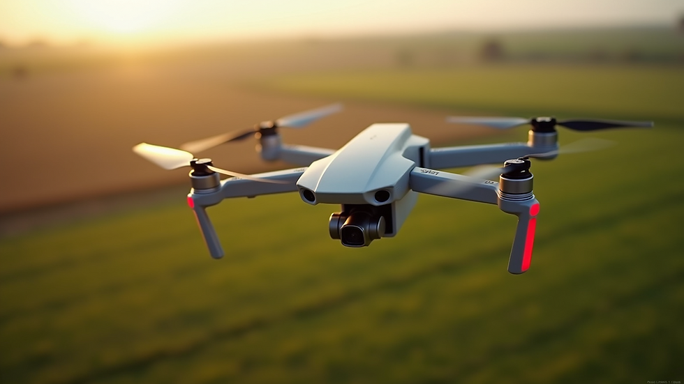
Professional imagery solutions have revolutionized the way industries collect and analyze spatial data. These solutions use drones, satellites, and manned aircraft equipped with advanced cameras and sensors to capture images from above. The result is a detailed, bird’s-eye view that reveals patterns and details not visible from the ground.
For example, in agriculture, farmers use aerial imagery to monitor crop health, identify pest infestations, and optimize irrigation. This leads to better yields and reduced costs. In construction, aerial images help track project progress, inspect hard-to-reach areas, and ensure safety compliance. Urban planners rely on these images to design smarter cities, manage traffic flow, and plan green spaces.
The key advantage of professional imagery solutions is their ability to provide real-time, high-resolution data that can be analyzed quickly. This enables faster decision-making and more precise interventions.
Technologies Behind Advanced Aerial Imagery Solutions
The technology powering professional imagery solutions is diverse and rapidly evolving. Here are some of the main components:
Drones (UAVs) - Unmanned Aerial Vehicles are the most common platform for aerial imaging today. They are affordable, flexible, and capable of flying at low altitudes to capture detailed images.
Multispectral and Hyperspectral Cameras - These cameras capture data beyond the visible spectrum, allowing for analysis of plant health, water quality, and material composition.
LiDAR Sensors - Light Detection and Ranging technology uses laser pulses to create precise 3D maps of terrain and structures.
Satellite Imaging - Satellites provide large-scale coverage and are useful for monitoring environmental changes and urban expansion over time.
Image Processing Software - Advanced software tools stitch images together, analyze data, and generate actionable insights.
Each technology has its strengths and is often combined to deliver comprehensive aerial imagery solutions tailored to specific needs.

Practical Applications and Benefits of Aerial Imagery Solutions
The practical applications of aerial imagery solutions are vast and varied. Here are some key examples:
Agriculture: Detecting crop stress early, mapping soil variability, and managing irrigation systems.
Construction and Infrastructure: Monitoring site progress, inspecting bridges and towers, and managing assets.
Environmental Monitoring: Tracking deforestation, assessing flood damage, and monitoring wildlife habitats.
Disaster Management: Providing rapid damage assessment after natural disasters like hurricanes or earthquakes.
Real Estate and Urban Planning: Creating detailed property maps, planning new developments, and managing zoning regulations.
The benefits include improved accuracy, reduced costs, enhanced safety, and faster turnaround times. For instance, using drones to inspect a bridge can save weeks compared to manual inspections and reduce risks to workers.

How to Choose the Right Professional Imagery Solution
Selecting the right aerial imagery solution depends on your specific goals and constraints. Here are some factors to consider:
Purpose: Define what you want to achieve. Is it crop monitoring, infrastructure inspection, or environmental analysis?
Resolution Needs: Higher resolution images provide more detail but may require more storage and processing power.
Budget: Costs vary widely depending on the technology and scale of the project.
Regulatory Compliance: Ensure compliance with local aviation laws and privacy regulations.
Data Processing: Consider whether you need raw images or processed data with analytics.
Service Providers: Evaluate providers based on experience, technology, and customer support.
For those looking to explore options, aerial imagery solutions offer a range of services that can be customized to meet diverse requirements.
Future Trends in Aerial Imagery and Data Analytics
The future of professional imagery solutions is bright, with several exciting trends on the horizon:
AI and Machine Learning: Automated image analysis will speed up data interpretation and improve accuracy.
Integration with IoT: Combining aerial data with ground sensors will provide a more holistic view of environments.
Swarm Drones: Coordinated fleets of drones will cover larger areas more efficiently.
Improved Battery Life: Longer flight times will enable more extensive data collection.
Real-Time Streaming: Live aerial video feeds will enhance monitoring and emergency response.
These advancements will make aerial imagery solutions even more accessible and valuable across industries.
Maximizing the Value of Your Aerial Imagery Investment
To get the most out of professional imagery solutions, consider these actionable recommendations:
Plan Your Flights Carefully: Define flight paths and timing to capture the most relevant data.
Use the Right Sensors: Match sensor types to your specific application for optimal results.
Invest in Training: Ensure your team understands how to operate equipment and interpret data.
Leverage Analytics Tools: Use software that can turn raw images into actionable insights.
Regularly Update Data: Frequent data collection helps track changes and trends over time.
By following these steps, you can enhance decision-making and improve operational efficiency.
Professional imagery solutions are transforming how we see and understand the world from above. With the right technology and approach, aerial imagery can provide detailed insights that drive smarter decisions and better outcomes across many fields. Whether you are managing crops, building infrastructure, or protecting the environment, embracing these advanced solutions will position you for success in the years ahead.

Comments